
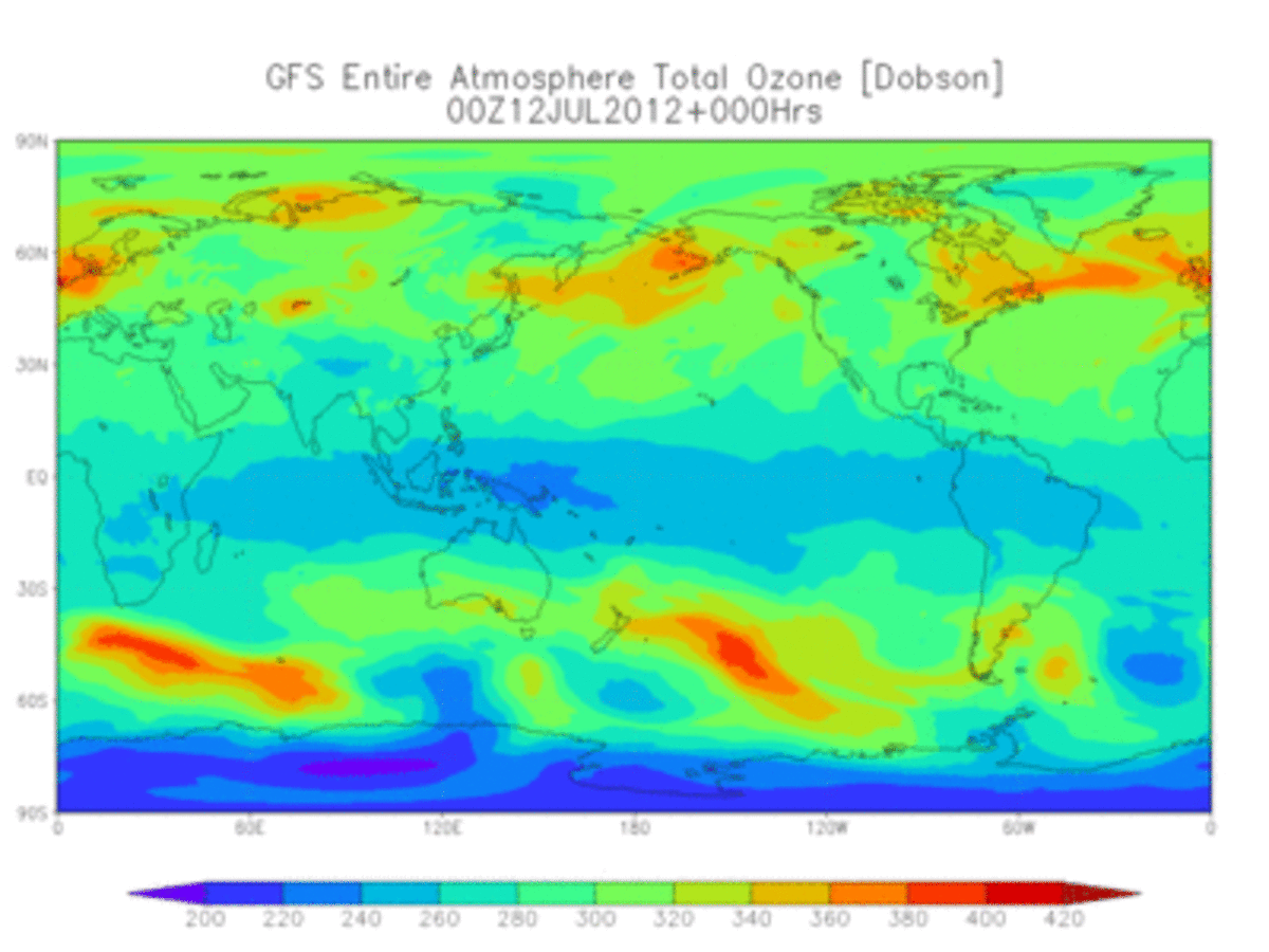
The Global Forecast System (GFS) is a National Centers for Environmental Prediction (NCEP) weather forecast model that generates data for dozens of atmospheric and land-soil variables, including temperatures, winds, precipitation, soil moisture, and atmospheric ozone concentration. The system couples four separate models (atmosphere, ocean model, land/soil model, and sea ice) that work together to accurately depict weather conditions.
Access Methods
GFS Data is available through a variety of access methods and formats.
The NOAA Big Data Program also provides access to gridded 0.25°- and 0.5°-resolution analysis and forecast data in a trailing 30-day window in the AWS Open Data Registry for GFS.
GFS Analysis and Forecasts
| Grid/Scale | Period of Record | Model Cycle | Output Timestep | Parameter Sets |
|---|---|---|---|---|
| 0.25° | 26Feb2021-Present | 4/day: 00, 06, 12, 18UTC | 1/cycle |
|
| 0.5° | 26Feb2021-Present | 4/day: 00, 06, 12, 18UTC | 1/cycle |
|
NCEI provides access to the following gridded analysis and forecast data from GFS.
GFS Analysis (GFS-ANL)
| Period of Record | Grid/Scale | Model Cycle | Output Timestep | Data Access Links |
|---|---|---|---|---|
| 01Jan2007–Present | 4/day: 00, 06, 12, 18UTC | +00, (+03, +06 precipitation fields) | ||
| 02Mar2004–Present | 4/day: 00, 06, 12, 18UTC | +00, (+03, +06 precipitation fields) |
GFS Forecasts (GFS Model)
| Period of Record | Grid/Scale | Model Cycle | Output Timestep | Data Access Links |
|---|---|---|---|---|
| 10Oct2006–Present (approx. two years to present online) | 4/day: 00, 06, 12, 18UTC | 3-hourly, +000 to +192 hours | ||
| 15Feb2005–Present (approx. six months to present online) | 4/day: 00, 06, 12, 18UTC | 3-hourly, +000 to +240 hours; 12-hourly, +252 to +384 |
GFS Forecasts (GFS-AVN Model)
Specifications
The model is constantly evolving, and regularly adjusted to improve performance and forecast accuracy. GFS is a global model with a base horizontal resolution of 18 miles (28 kilometers) between grid points. Temporal resolution covers analysis and forecasts out to 16 days. Horizontal resolution drops to 44 miles (70 kilometers) between grid points for forecasts between one week and two weeks.


